Explore Elevation with 实时高度表 App

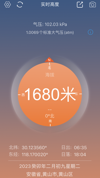
实时高度表 is a travel and navigation app designed for outdoor enthusiasts, providing real-time elevation data and essential location information. Users can access GPS coordinates, direction, speed, and atmospheric pressure, making it a versatile tool for adventurers. The app also allows users to annotate photos with elevation data, which can be saved to the photo library or shared on social media platforms.

Key features include real-time elevation tracking, a compass for directional information, and the ability to mark and save elevation points. Users can view a leaderboard showcasing the highest elevations achieved by each user. Additionally, the app offers a 'My Footprints' section to display all marked elevation data in a map view, along with sunrise and sunset times for the current location.

 0/1

App specs

  • License

    Free

  • Version

    2.9

  • Latest update

  • Platform

    iPhone

  • OS

    iOS 16.4

  • Language

    Chinese

    Available languages

    • Chinese
    • Chinese
  • Developer

Program available in other languages


User reviews about 实时高度表

Have you tried 实时高度表? Be the first to leave your opinion!

You may also like

Explore Apps

Latest articles

Laws concerning the use of this software vary from country to country. We do not encourage or condone the use of this program if it is in violation of these laws.
Softonic
Your review for 实时高度表
Softonic

Score result: Clean

This app is available directly from the official App Store. Since the official app stores maintain their own rigorous security standards and review processes, we rely on their trusted distribution platform rather than performing additiona scans. You can download with confidence knowing this comes straight from the verified source.

  • Virus free
  • Spyware free
  • Malware free